Showing posts with label Peter Skiba. Show all posts

Sunday, September 4, 2011

Treasure caching


Peter and I drove about 50 miles east of Fort Collins past the town of Ault to Highway 390 for the start of our geocaching adventure.  Our plan for the day was to meander along the Pawnee National Grasslands power trail and head north toward the town of Grover, CO picking up many caches.   Caches are hidden about a half mile apart.


 Our normal process is  to consult the GPS, count down the feet to ground zero, stop the car with both of us getting out to look for the hidden treasure. But  the constant repetition due to the relative closeness made this too time consuming.  So I took over the driving chores and  Peter hopped out each time I stopped.  He located the cache, signed the log and hopped back into the car. This worked out better.  We stayed on the dusty dirt  roads traveled only by  us and the occasional oil rig truck , cattle trailer or pick up truck.  The road followed the edge of the Pawnee National Grassland.  We saw windmills with water troughs, oil wells surrounded by cattle, prancing pronghorn antelope, grazing sheep, and cottonwood trees along an occasional stream crossing.  We are thinking that this would be a good place to come back to for pictures in the spring time.


 We discovered and signed over 120 caches for the day.  Our little blue Prius was coated with dust.  Our floor mats were plush with gravel and stones.  Exhausted and tired of the confines of our little car we head north to Wyoming (almost to the border by this time) and stop for a bite to eat at the local truck stop in Cheyenne.  All told, we set a personal record for number of caches in a day.

Upon reflection, the farmers, ranchers and settlers of this austere grassland must have been hardy, dedicated, self reliant folks.  They must have felt comfortable with themselves and have been highly motivated to endure the demands of this national  historic treasure.

Saturday, August 13, 2011

Geocaching in West Bend

What do you do while you're waiting two days for your 50th Grade school reunion to happen?  When you're Peter and Renee Skiba you geocache!

We traveled to Milwaukee the second week in August to attend Peter's Grade School Reunion.  Having graduated in 1961 from St. John Kanty meant that you lived in very close proximity to about 60 other children during many of your formative years.  We learned together, we played together, we went to church together year after year.  We formed relationships that have lasted decades.  But the event was not going to happen until Saturday evening.


Since we had time on our hands we decided to participate in the 4th Annual West Bend Geocache Bash starting in Regner Park.  Geocaching is a world wide phenomenon wherein cachers seeks out hidden treasures using a Global Positioning System (GPS) device to guide them to the location of the cache.  We registered at noon on Friday with our caching handle, Pixelmagic, and learned that we were to be among a total of about 1600 teams participating in the event.  66 new caches were published specifically for this event in and around the greater West Bend area. 

Friday afternoon we headed to the northernmost caches and followed roads, trails and paths to get to the caches.  A sports themed series through the woods led us along buggy, shaded, hot trails to find a baseball cache at the end of a long branch propped against a tree and a basketball cache high in a tree trunk complete with hoop and net.  The themes and placement were well thought out and funny.  We met Dan and Vicki at registration and caught up with them in the woods.  It took some serious walking and hiking to complete 30 caches in the afternoon.

Saturday we were back in the rainy West Bend area attempting to get our share of the caches along with several hundreds more walking along the paved and not so paved trails.  We had a blast in West Bend.  Thanks for the cache.


Sunday, August 7, 2011

Sheer face of the Third Flat Iron


Why would I set my alarm clock to ring at 3:15am on Sunday?  To get up of course for my next outdoor climbing adventure.  I need to leave Fort Collins by 4:15 to get to the parking lot of Chautaqua Park in Boulder by 5:30 to meet my son Doug for our next climb.  The planned conquest du jour is to scale the face of the third flatiron in the morning before the sun heats up the rock and makes it uncomfortable to the touch and avoid any possible afternoon storms.


I have seen the flat irons from a distance.  They look big.  I'm not sure if I have a short term memory issue relating to the size and scale of mountains, but as I get closer to the exposed rock I am awed by the size of the height and width of the bare rock.  It takes us a while to get to the base of the rock formations.  We hike along the road and trails past the first, past the second, and finally to the trail that leads to the start of the climb of the third.  We hike over rocks and boulders doing a couple of switch backs till we get to the start of the climb.  At the base of the climb, I look up and see rock and more rock.  This is a tall climb.  Years ago I climbed Devil's Tower in Wyoming with both of my sons and with Heidi, Doug's wife.  That climb to the top of the Tower was big and it looked big because of its isolation and rise from the surrounding land.  This climb exceeds the climb of Devil's Tower but is disguised because of the proximity of the other Flat Irons.  We wait our turn behind  two pair of climbers who made it to the trail head just before us.  Doug is leading our climb and will place temporary protection in cracks and crevices of the rock so that our rope can flow through these anchor points and arrest any fall.  My job is to belay him as he climbs and sets a route safe to follow.  Once Doug reaches a permanent bolt he will set up a belay station and allow me to climb and clean the route by removing the temporary anchors as I climb to reach his new position on the rocks.  This process is repeated as we complete each pitch up the massive vertical slab of rock.  Sometimes the anchor is a fancy piece of hardware known as a cam.  Other places a simple sling is placed over a knobby rock and a quick draw is attached to allow the rope to freely move through a carabiner.  The route up is steep but the rock features many holds that allow a climber to step onto or grab a hold of.   We are wearing climbing shoes, skinny soled wraps that use sticky rubber on the bottoms and sides that allow for good traction as we move across the rock.  Using the holds and the shoes we move ever higher up the rock with each pitch of the climb.  About midway up the rock on the third pitch , Doug noticed a rookie climber close by with a lot of rope hanging slack in front of him.  Doug advised him to yell "up rope" to his belayer before moving on.  If the climber would have fallen, he would have extended his fall by the yards of extra slack that had accumulated in his rope.  The belayer has the responsibility of staying current with his climber.  But sometimes there is no visual contact between the climber and the belayer. The climber must communicate with his partner to stay safe.  Standard commands are used as climber jargon which sometimes must be shouted up or down the length of the rope.  Doug and I  follow an easy routine with each pitch.  At the start of each new pitch we flake out the rope to eliminate tangle and knots, double check our harnesses and continue upward.  This repetition is comforting as we move along the route climbing ever closer to the summit.  On the fourth pitch we see peregrine falcons circling and squawking about humans invading their space.  The spring months are off limits to climbers on the flatirons because of the nesting habits of the raptors in the areas.  This climb has just been opened because the young birds are able to now move from their nests. The final pitch moves over a huge gap in the rock called the gash, that seems to drop down forever.  Doug led this spot by climbing upward and found a small traverse to get over the gash.  We summit and share the top with four other climbers who join us there.  We stand about 1300 feet above the trail we see below populated with walkers strolling along.  We look around and decide that this is a good place to be.

After a little conversation and admiration of the surrounding country side, we are offered a ride on the rope of our summit partners.  The ride is down, straight down.  We share the rope and each take turns rappelling down the rope to the next rappel station.  After three rides down we are at the start of the hiking trail leading back to the start of the route.

We congratulate each other as we move down the trail smiling both inwardly and outwardly as we have conquered another obstacle and have done it safely enjoying each others company along the way.  Thanks Doug.


Sunday, July 31, 2011

Climbing Long's Peak

Today is the day Peter, Doug & Heidi have been waiting for and training for.  They are now climbing Long's Peak in RMNP.  Peter left here last night at 10PM with the plan to meet with Doug & Heidi at the trailhead at about midnight.  They had plans to start the long hike in the nite so that they could summit before the ever common afternoon storms broke through.  It is now about 2:30PM on Sunday and I have not heard from them.  Hoping that that is just because there is no phone service where they are headed. 

Longs Peak in Rocky Mountain National Park

Douglas, Heidi and I met at the Longs Peak Ranger Station parking lot at midnight Saturday to start our journey to the summit of Longs Peak.  The vertical climb is 5100 feet to the summit of this 14er.  We have been training this year by hiking and climbing.  I have been hiking in the Poudre Canyon summiting some of the many ranked peaks there, but the hikes have been 8 or 9 miles long and the elevation gain was less than 3,000 feet.  We also climbed Mount Elbert which is the tallest of the 14ers in Colorado.  One of the big distinctions of Longs is that much of the climb is considered Class 3, requiring use of hands and feet to scramble along rocks.  This demands concentration, care and keen sense of balance.

We hiked in the dark using headlamps to light the way through the pine trees.  We crossed rushing streams that we could hear better than see.  We switched back and forth winding our way up to treeline where the clear sky revealed stars without end.  When we glanced back down the slope we started to see a parade of lights dancing through the trees below.  Other hikers had started the climb as well.  The city lights of metro Denver blazed from below providing a compass of sorts showing east instead of north.

With no sleep since sunrise on Saturday, the effects of the elevation gain are wearing me down.  We stop for snacks along the way to stay nourished during this calorie burning trek.  At about mile four, I'm feeling a little light headed.  My 15 pound pack is starting to feel heavier than it should.  At one of the breaks, I curl up on a foam pad and close my eyes, but sleep eludes me.  After a few minutes of quiet, I rise and feel a little better.  Faster hikers, those of muscle and youth, pass us up as we wish each other well.

The eastern sky lightens as we gain elevation.  Instead of dark shadows, I can now make out sharper outlines of the peaks in front of us.  The change in terrain is evident as the size of the rocks grow bigger and bigger.  Instead of walking, we are now hopping from rock to rock balancing on the soles of our boots hoping that the rock we jumped on is stable and doesn't move.  A trail sign announces that the "boulder field" is just ahead.  Our dance across the rocks purposefully protects the fragile alpine plants.

With first light we can see tents of campers ahead in the midst of acres and acres of boulders.  A structure ahead is the target for our dance line.  The building is the site of the solar powered privy.  The toilets are really just elevated toilets surrounded by a short fence for privacy.  This rest stop is a welcome relief.

The "Keyhole" is the next landmark.  Moving through this hole in the rock moves us from warm morning sunlight into the shade of the mountain.  We travel along the back side of the mountain close to the base of the rock.  The exposure and drop to our right is sharp and steep.  Thousands of feet of drop.  People have died along this stretch of rock.  This is the start of the Class 3 scrambling.  Painted markings dot the way winding steadily upward.  We take turns leading the way finding the best rock for good footing and looking for hand holds as well.  Some sections are crumbly and slippery.  We try to avoid those areas as dangerous for our own safety as well as for those below us.  Rocks spilling downward can be serious trouble.  My progress is slower than Doug and Heidi and they relieve some of my burden by pulling some weight from my pack and adding it to their own.  Thanks guys.  Progress is slow but steady along the "Narrows".  After what seemed like miles through the Narrows we turn into the Trough for an even steeper climb to the "Home Stretch".   Every foot step and every hand grab requires attention up this steep section of the rock face.  I'm not thinking about breathing at this point because we can see the summit point and the adrenaline kicks in.  We made the summit by 10:00.  This area is huge and flat and awesome.  We remove our packs and celebrate with some snacks.

Heidi unfurls her Ostomy Awareness banner and celebrates her success.  Doug upends himself with his traditional summit headstand.  I sign in at the summit log and down we go to complete the climb in reverse order.  Gravity helps, sometimes a little too much, on the climb down.  We move on all fours down the rock facing outward for much of the sheer vertical drop.  Where there is no rock protecting against a precipitous  fall we turn and face the rock and climb down.  There is much traffic on the climb today.  We must wait our turn and allow others the chance to climb at their own pace.  Doug reminds me that accidents most often happen during the euphoria of success and the rush to get back down.  We move slowly and methodically down the sheer rock face.

Doug stopped along the boulder field to filter a new supply of ice cold water for the rest of the trip.  The cool water is refreshing.  The hike down is long.  We're working on energy supplies that have dwindled.


We celebrate that the weather has been great all night and so far during the day, but we see clouds starting to fill the sky.  As we near the tree line the clouds now dark with rain start to break loose and share the moisture with and on us.  The rain is great, but the lightning storm that came along with it is near and loud and fierce.  We hurry along the trail now sloshing through the muddy pathways and sliding on slick rocks.  The lightning is scary.  It is real and close.  We continue quickly along the trail that eventually leads to the trail-head.  Despite our rain jackets and pack covers we are drenched to the skin.  The rain came in hard, cold, steady streams. Everything was shiny and wet.  After changing into whatever dry clothes we had at the cars, we unceremoniously depart anxious to return home and rest our sleep deprived and weary bodies.  It will take days before I can take in the literal enormity of this trip to the top of Longs Peak.

Monday, June 27, 2011

Mount Elbert

Yesterday, Peter, Doug and Heidi stood on the highest peak in Colorado.
What a joy!  They are preparing for their ascent of Long's Peak in August.
Such ambition.  This is the 3rd 14,000+ peak that Peter has done since moving to Colorado.
We moved here almost exactly one year ago.  On this day a year ago we were driving our truck full to our new home and waiting to close on our new home.

Saturday, June 4, 2011

Prospect Ponds Hike

Today we headed to Prospect Ponds for a hike/geocaching adventure. The area is about 10 minutes South of our home. It is a natural area that is popular to hikers/walkers/bikers/dogs.
We took advantage of the cooler weather in the morning to head out. By the time we were done, it was getting very warm and we were glad to head home to cool off.

The first part of our day took us on an easy hike around the ponds. We found the cache easily, signed the log and headed back to get our next cache. The next one was about 1.5 miles from the first so we chose to drive part of the way. We parked at the CSU Environmental Learning Center.

Leaving the parking lot, we walked across a swinging bridge. Of course Peter had to be the funny man and shake the bridge as I was going over. Hmmmmm! Children! Do they ever grow up?! Let's hope not.

We followed the trail to get to the next multi cache at the south end of the Center. Along the way we came across fields of phlox being munched on by deer. Deer that were so used to humans, that they stood still (for a bit) to have their pictures taken. We continued on. Arrived at the coordinates and began our search. We had to get through some high grasses and swat a couple of dozen mosquitoes, but Peter's eagle eyes spotted the clue! It gave us coordinates to the 2nd part of the cache. We again went off trail for a bit and headed toward the La Poudre River. The water was high and flowing rapidly. Spring thaws have brought a lot of water down from the mountains. We found the cache, signed the log and returned to the parking area. There was one more in the area, but we chose to leave that one for another time. We went home to clean up and get some bug lotion for our bites. Another great day enjoying the great outdoors. What a joy it is to live in an area where all of this beauty is nearby and just waiting to be found!

Friday, June 3, 2011

Youngs Gulch Trail

We left home this morning intent on finding at least 3 geocaches in the Poudre Canyon on the Youngs Gulch Trail. The first one was to be a multi cache with 3 parts and the 2nd and 3rd were traditional ones.

We drove to the trail head, parked, got out our walking sticks, packed up our backpacks and headed out on the trail by 9:30AM. We knew from descriptions written that we had to walk about 2 miles in and would have to cross a stream several times over. Seems to be a popular area as there were several cars in the parking lot already. Peter had hiked the complete route (8 miles round trip) a couple of days earlier to be the First to Find a new cache that was hidden on the trail.

As we came to the stream crossings, it was comforting to know that "someone" had thought ahead and placed large boulders in the water to use as stepping stones. Some were covered in water but for the most part they made the crossings easier. As I stood on one side of the stream I had to talk myself into crossing to the other side. Fear of falling is a big part of my hesitancy, but I made it.

Along the way we were blessed to find many new wildflowers blooming. Some we had not seen, but many that were known to us by name....Pasque Flower, Golden Banner, Larkspur, Shooting Stars, Colorado Columbine (first one to see this season) and the Star Flower. We're sure there were others, but too many to name. We came across many other hikers along the way with dogs of many varieties.

We only went off trail to find the clues for the caches and to grab a bite to eat. Then we pressed on to the next stop.

We were doing fine. I was counting the stream crossings and had made it to 12 without any problems. Then # 13 came along. Must have been getting tired, or it was just an unlucky number....anyhow I slipped. Landed on my left fingers and knees. Then somehow landed on my chest. Peter came to the rescue. Finger started to swell and was painful, but we had places to go....so we continued on our way! Before reaching the cache at the end of the trail, we counted a total of 18 crossings. Some more difficult than others. Later in the hike we came across another hiker who had a large "bite" taken out of his straw hat. Asked him what happened, and he said a pterodactyl swooped down and bit it off. Said he had to fight it off! We then wondered if that same pterodactyl was responsible for knocking me off the boulder in the 13th stream crossing. Amazing! So nice to have a worthy explanation of what happened and not think that it was just me being clumsy!

We did accomplish our task that we set out to do. Found all of the caches, had a wonderful hike in the wild, did not break anything and enjoyed each others company. What more could you want on a spring day in Colorado?

Saturday, May 28, 2011

Visitors from Wisconsin


This week our dear friends Paul and Maris Fried stayed with us in Fort Collins, Colorado. They drove one thousand miles to visit and spend time together. We had the opportunity to show them around the Front Range and do some hiking in the Poudre Canyon. They joined us seeking out geocaches in town and in the surrounding regions.


Paul and Peter took the hike to the top of Horsetooth Rock and Renée and Maris hiked the trail to Horsetooth Falls.

Paul was able to complete a Earthcache with information he gained from signage at the top of the Rock.
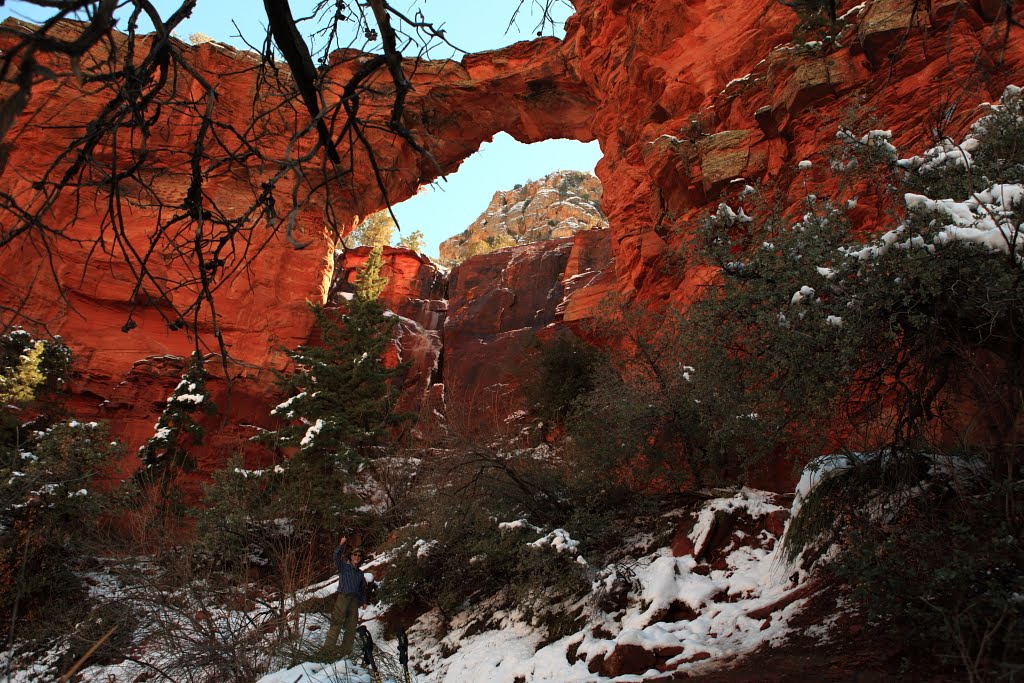
The Rock overlooks the City of Fort Collins to the north.


Sunday, March 13, 2011

Rocky Mountain Raptor Program


Peter and Renée visited the Environmental Learning Center while geocaching in Fort Collins on Wednesday. They noticed that the were fenced in enclosures on the premises that had wild birds of prey within. Pretty cool wild birds!

Two geocaches remained to be found when we quit for the day. We returned on Thursday and found the caches on the trails nearby. When we returned to the parking area we noticed some volunteers near the enclosures with something flapping huge wings. As we approached we saw that the flapping wings belonged to a golden eagle that we learned was ill and unable to fend for itself in the wild. It is being kept and trained as an educational ambassador for the Program. We were treated to a special opportunity to learn about this eagle and about the Program which has a rich and successful history. Originally linked to the University (CSU) it was spun off and now has a home of its own right here in Fort Collins. Volunteers travel the State with the birds and provide educational opportunities for lots of folks. They treat and release raptors like eagles, owls, hawks and falcons. Since 1979 the have cared for over 5,000 injured raptors.

Thursday, March 3, 2011

Carroll Canyon Trek


Peter joined fellow Wyndham Vacation Resort timeshare guests staying at the Sedona Resort on a hike to Carroll Canyon. The hike was hosted by Wyndham Activities Supervisor, Elyse James. Fellow Hikers included Charleen and Bob from Albuquerque and their neighbors and friends, Vikki and Herman. Elyse confirmed that we were about to go on a moderate hike with steep and muddy areas and gave each of us the opportunity to opt out if we wanted to. With no defectors, we started out on city streets to get to the trailhead for the start of several Carroll Canyon hikes. With plenty of water on hand we ventured out onto the trail. Elyse explained the fragile environment we were hiking through and that uncompacted soil could be damaged by mere foot pressure. That damage could take decades of time to overcome. We were careful to stay on the trails and not wonder off trail. Leader Elyse, while setting an aggressive pace, stopped from time to time to make sure everyone was okay.

We reached the culmination of our trek dubbed "Elyse's Overlook" and peered over the edge of massive rocks onto the wet wash of Carroll Canyon. With Thunder Mountain in the background the city of Sedona came into clear view.

With pleasant company and good conversation the trip was over it seemed in no time. With one hike under my belt what could be next on the agenda? Maybe a little geocaching?

To the top of Scheurman Mountain

On Wednesday morning we headed south of town to take the Red Rock Loop Road.
One of the first stops was to hike to the top of Scheurman Mountain.
This was a suggestion of our new geocaching friends, Mike and Julie.
The hike would take us to a couple of their caches.
Renee opted to stay at "base camp" and direct Peter if he needed help
in locating the cache (s). Peter took off with hiking sticks, water, backpack and a
lot of energy to hike up the trail.

He located the first cache with no difficulty and then called back to Renee
for directions to the next 2. Along the way he met up with a couple of other hikers
who were from Pennsylvania. He introduced them to geocaching.
Pictures were taken and then Peter was on his way to the next cache.
He located 3 of the 4. Great vistas and great pictures. Certainly a site to return to
for wonderful sunsets or sunrises.

After his 2.5 hour trek, Peter & Renee continued on the Red Rock Loop Road stopping at intervals to grab a couple of more caches and enjoy the vistas. We stopped at places that we
may not have normally been attracted to for a stop.

Great day. Headed home for some rest, a hot shower, dinner and some news on TV.

Peter logging into a cache at the top of Scheurman Mountain.

Overview of Sedona from one of the overlooks along Red Rock Loop Road.

Renee at one of the stops

Monday, February 28, 2011

Hike to Devil's Bridge is Heavenly

On a Forest Service Road still wet and muddy from Sunday's snowfall and closed to vehicles, we ventured out toward the trailhead looking for Trail 120, the pathway to Devil's Bridge. We got a late start, following some time share business, but began with the sun shining and almost no wind. It felt good to be heated by the warm sun on our bodies covered with protective clothing. We slid a lot on muddy red sand as we proceeded down the roadway. We saw the first butterflies of the year. Too quick and flighty to capture with a camera, but beautiful anyway. On first glance they appear white, with closer scrutiny bands of orange blaze along the outer edges of the wings. On the trail three hikers passed us up as we looked at plants and critters.


After about a mile, Renee, figured it was prudent to head back toward the car. Peter trudged on to find the entry way to the trail. Once at the trailhead (4600 feet), Peter continued the mile to the top. At the Bridge I found Athanasia and her two cousins at the top posing for pics after climbing and sliding on icy stones. We traded pics. Steps were treacherous on the way down. Apart from the icy spots the hike was great.

Sunday, February 27, 2011

Snow in Sedona

Woke up this morning in Sedona to a beautiful site outside of our window.
Heavy snow! Hanging from the trees, covering the red rocks in the mountains.
We are heading out to enjoy some of this beauty before it is only a memory.

Sunday, February 6, 2011

Red Rock Canyon State Park

On Tuesday, Feb 1st we chose to have an outdoor adventure.
We traveled about 30 miles of Vegas to Red Rock Canyon State Park. Doug & Heidi had told us before leaving on our trip that this was one of the places we should not miss.

It was a cool day (30's) and the winds were quite strong! Peter even was blown over at one of his picture taking walks. Strong winds mixed with sand and grit made for a bit of facial pain when you forgot to cover up. I even lost my hat, but Peter being the gallant man he is went over the edge to retrieve it! Hooray!

On Tuesday, we just drove through the park loop, stopped for a couple of caches, some pictures and a brief hike. We returned on Wednesday so that Peter would be able to walk through the Ice Box Canyon Trailway. He took almost the entire trail hoping to see some frozen waterfalls. I stayed behind and went for a much shorter walk in the opposite direction.


Visitor's Center where Peter made a new friend who insisted on following him around!

Part of our geocaching search.

Hiking up the rocks. Bundled up to protect from the wind.

Red Rock Canyon--- Calico Basin

Wednesday, January 5, 2011

First Winter Hike

Fort Collins has wonderful Natural Areas that are both supported and patronized by the citizens of the city. The Gateway Natural Area was the spot I chose to explore, hike and photograph. Historically this site functioned as a water treatment facility that outlived its original usefulness. This spot is where the North Fork and the Cache La Poudre River meet.


I took a short and steep hike up the Black Powder Trail to the summit of 5800 feet. The trail runs up a rock and dirt trail through ponderosa pine, rocks and grasses. The dam creating the Seaman Reservoir is visible along the upper reaches of the hike. There is evidence of past fire with the charred tree bark and trees fallen and burned.
The water of the North Fork River flows out of the Seaman Reservoir to the north and joins the Cache La Poudre at the Park Area. There is a parking area with restrooms available.
It appears that trout fishermen try their hands year round stalking their version of rainbows.

Sunday, October 31, 2010

Red Mountain Open Space


On Friday we decided that our adventure for the week would take us North of Fort Collins.
We had been told earlier in the week that the Red Mountain Open Space would be a good place to explore.
So with the weather predicted to be in the upper 60's we got out our map and headed north about 25 miles. On the way we stopped to catch a few geocaches en route.

Arriving at the Open Space we noted that one of the parking lots was closed due to rattlesnake hibernation. So we parked lower but had to walk through that parking lot to get to the trails. On the trail, I kept my eyes wide open in hopes that a rattler would not show itself on my path. With the warm weather I thought that they would be coming out of their hidey-holes! But none that we saw.

On our walk we had to cross a couple of creeks. I am always leery, but managed fine with Peter's encouragement. Of course Peter had to ham it up for the camera while he was crossing. No worry he has not fallen yet no matter how much he packs along with him!

And me going the opposite direction.

Peter getting down into the rattlesnake/cacti area.


Some of the wonderful birds nests that we found along the way. Built right into the side of the mountain.

Tuesday, October 19, 2010

Rocky Mountain National Park

Peter & I got off to a very early start this morning. Alarm went off at 4AM. Our plan was to get to RMNP for a sunrise. We arrived at about 6:30AM. Drive into the park was uneventful....no large animals in the roadways! Arrived in the park before the staff was there to check us in. Our plan was to look for elk today, photograph a sunrise and do some geocaching.

Initially went to Bear Lake for the sunrise. On the way up to that point we first came across some wonderful glistening frost on the low lying plants. As we progressed farther up, the frost turned to snow. Lovely to look at with the aspen trees still glowing their beautiful golden hues. There were about 4 other cars in the parking lot when we arrived. One was covered with snow so we presumed that the occupant (s) had spent the nite up higher on an overnite hike.

Peter proceeded to walk to Bear Lake along with another photographer who arrived at the same time. Said the water was not calm, so not terrific for reflections, but still beautiful with the recent snowfall.

Sunrise at Bear Lake in Rocky Mountain National Park


Sunrise showing alpenglow at Bear Lake a few minutes after the initial shots.


Large bull elk taking a rest. Alone. Before or after his harem duties???!!!

As our car was almost empty of fuel, we then headed back to Estes Park to refuel the car and ourselves. We stopped for breakfast at a small restaurant called "The Other Side". Hearty breakfast of shared Denver Omelet, Blueberry Pancakes and coffee.

Following breakfast we decided to do some geocaching in the area. I had looked up about 10 places the night before. We were ready. We found all but one. Perhaps it had floated down the river or been taken by someone? Will never know. But the places we did get to were interesting.

Left this morning when the temperature was a mere 28 degrees and returned to Fort Collins where it was 70 degrees! What a pleasant way to spend a fall day!